Upper Mustang Trekking
Lomanthang
upper-mustang-trekking
Upper Mustang Trekking

Upper Mustang Trekking- 17 Days

48 Reviews in TripAdvisor
52 Reviews in Google

Upper Mustang Trekking in Nepal was officially opened in 1992 and limited numbers of trekkers are only allowed each year in order to protect and conserve the local Tibetan tradition and the fragile environment.

Trip Facts
Duration: 17 Days
Trip Grade: Fairly strenuous
Country: Nepal
Maximum Altitude: 4010 m / 13156 ft (Nyi La Pass)
Starts: Kathmandu
Ends: Kathmandu
Group Size: 2-16
Activities: Trekking and Adventure
Best Time: Beginning of March to end of Nov

Upper Mustang Trek Highlights

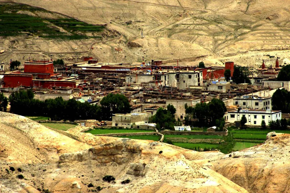
  • Walk back to the history of Lo Manthang after exploring the palace of the king
  • Walk freely without worrying about the rain, as the region lies in the rain shadow area
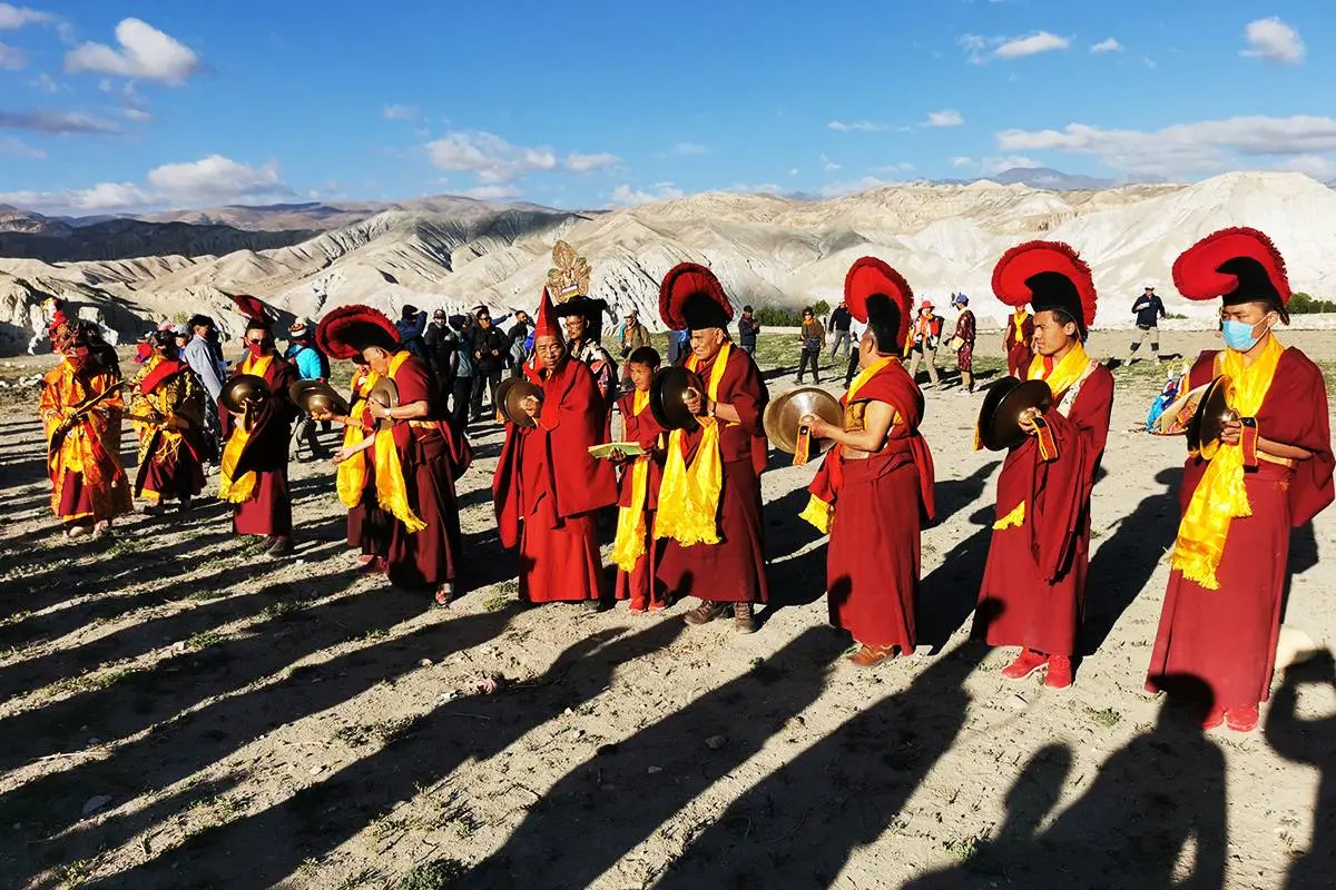
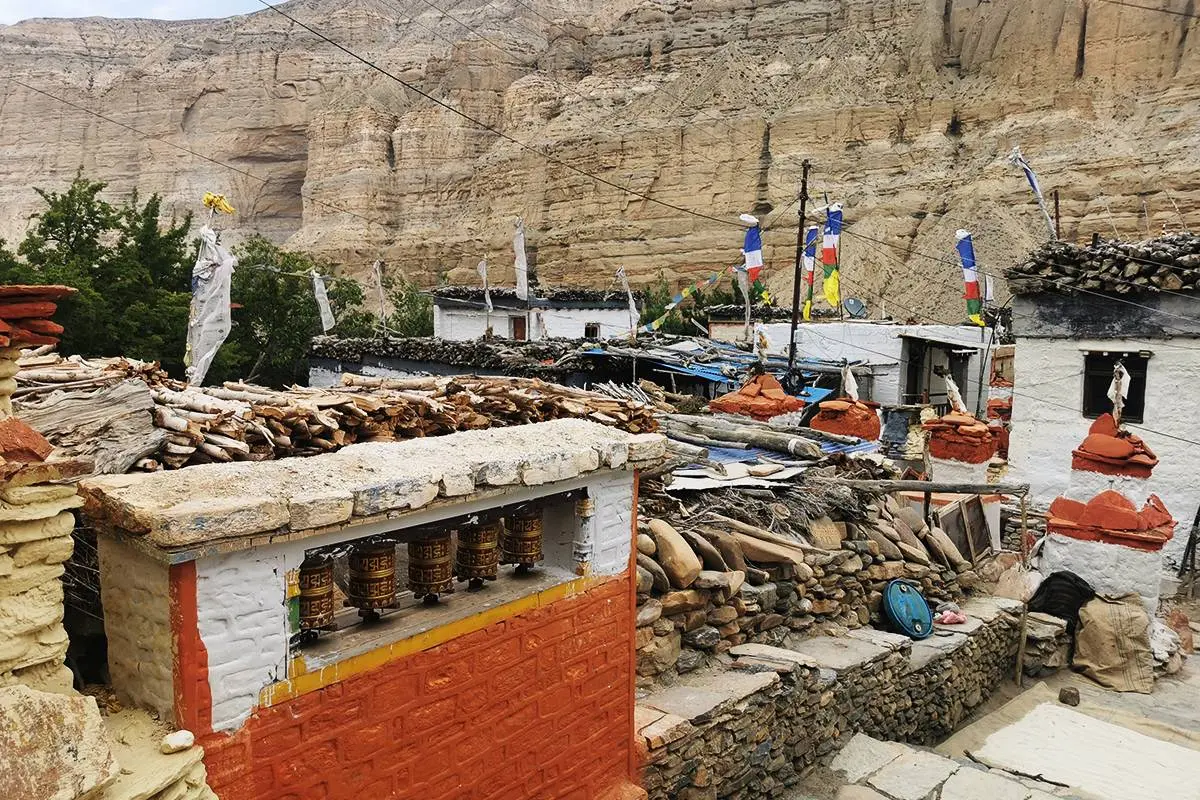
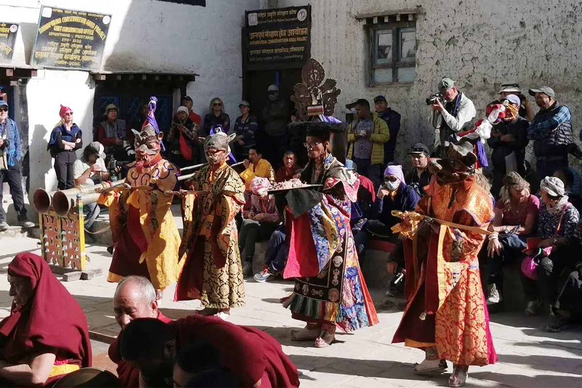
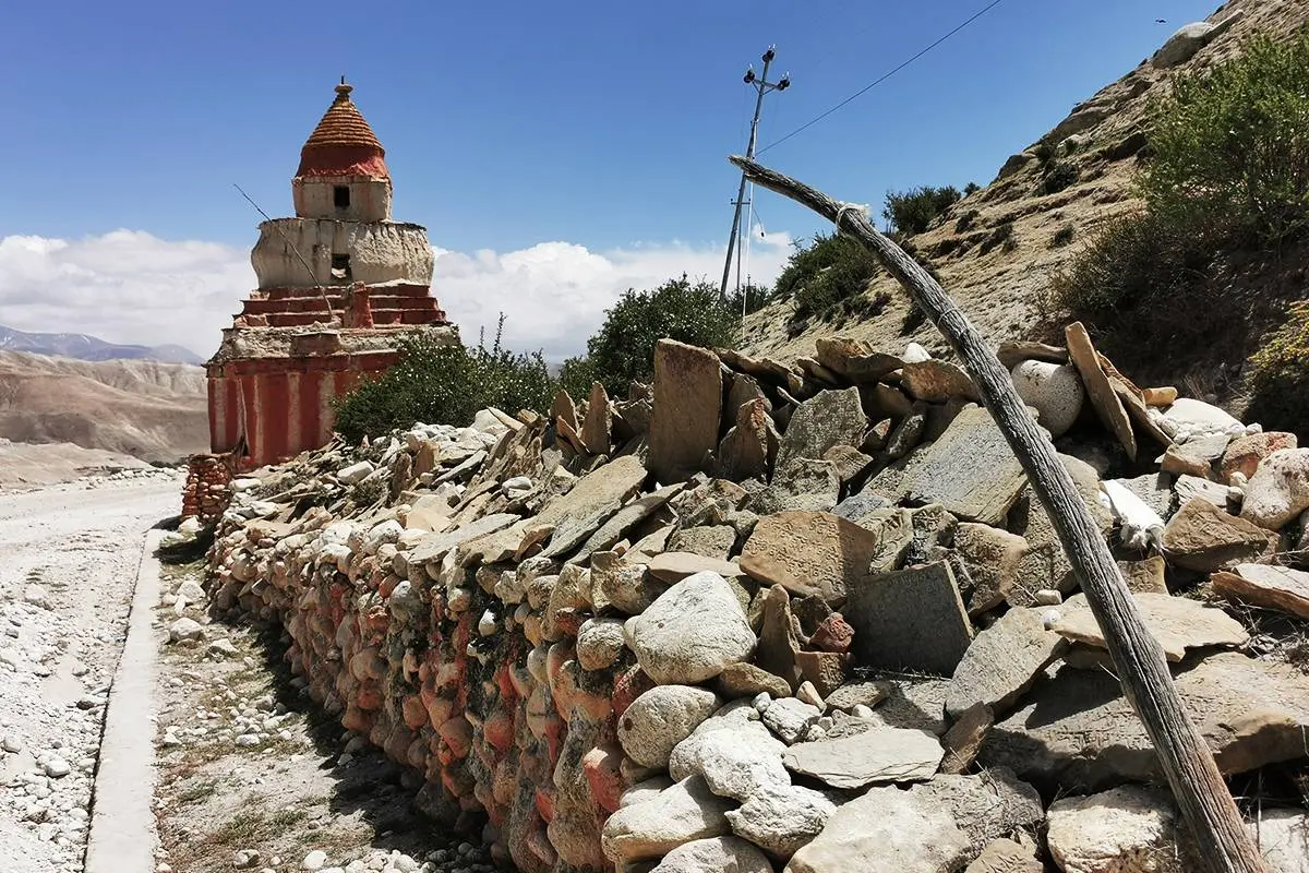
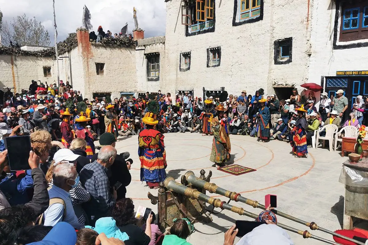
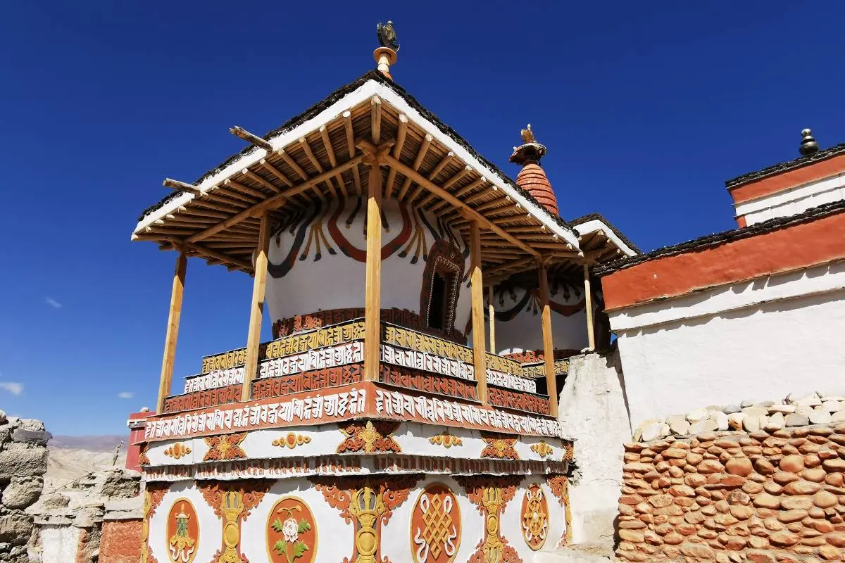
  • Spiritual feel walking through many Gompas, chortens, flapping prayer flags, and caves
  • Catch a live glimpse of Tibetan influence on the everyday activities and culture of the locals
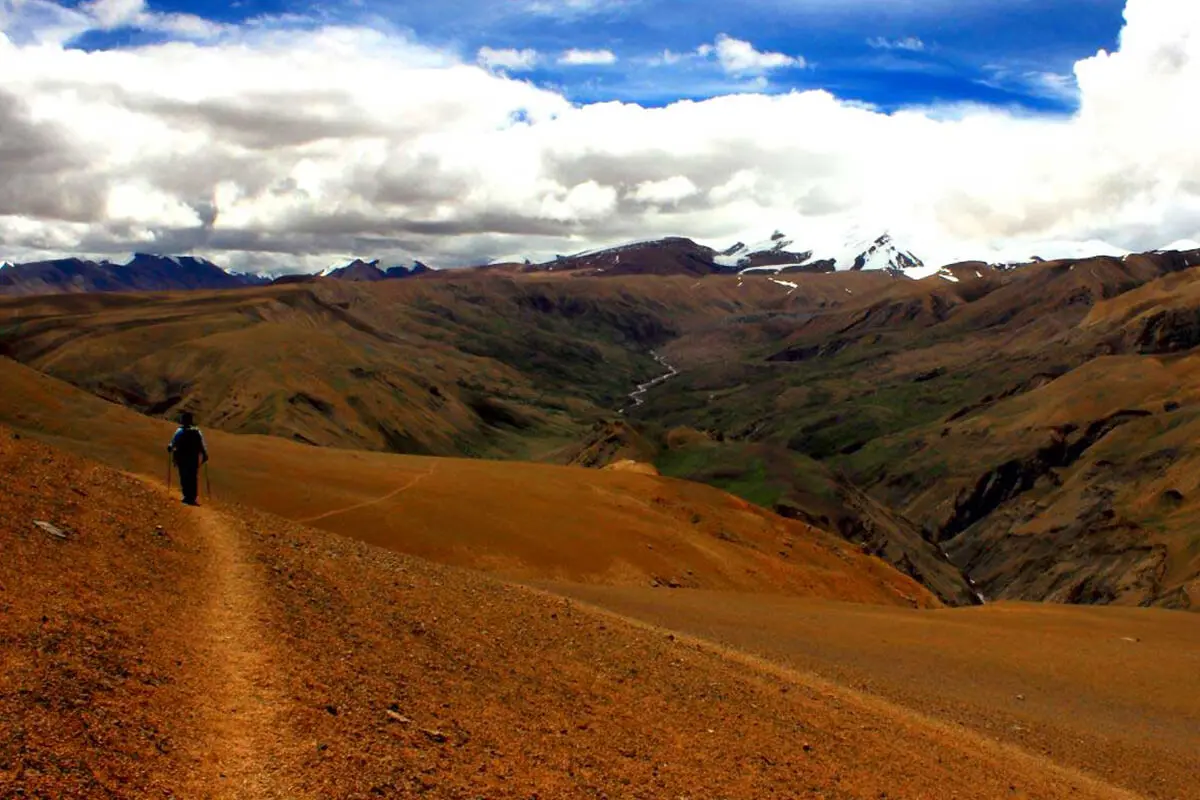
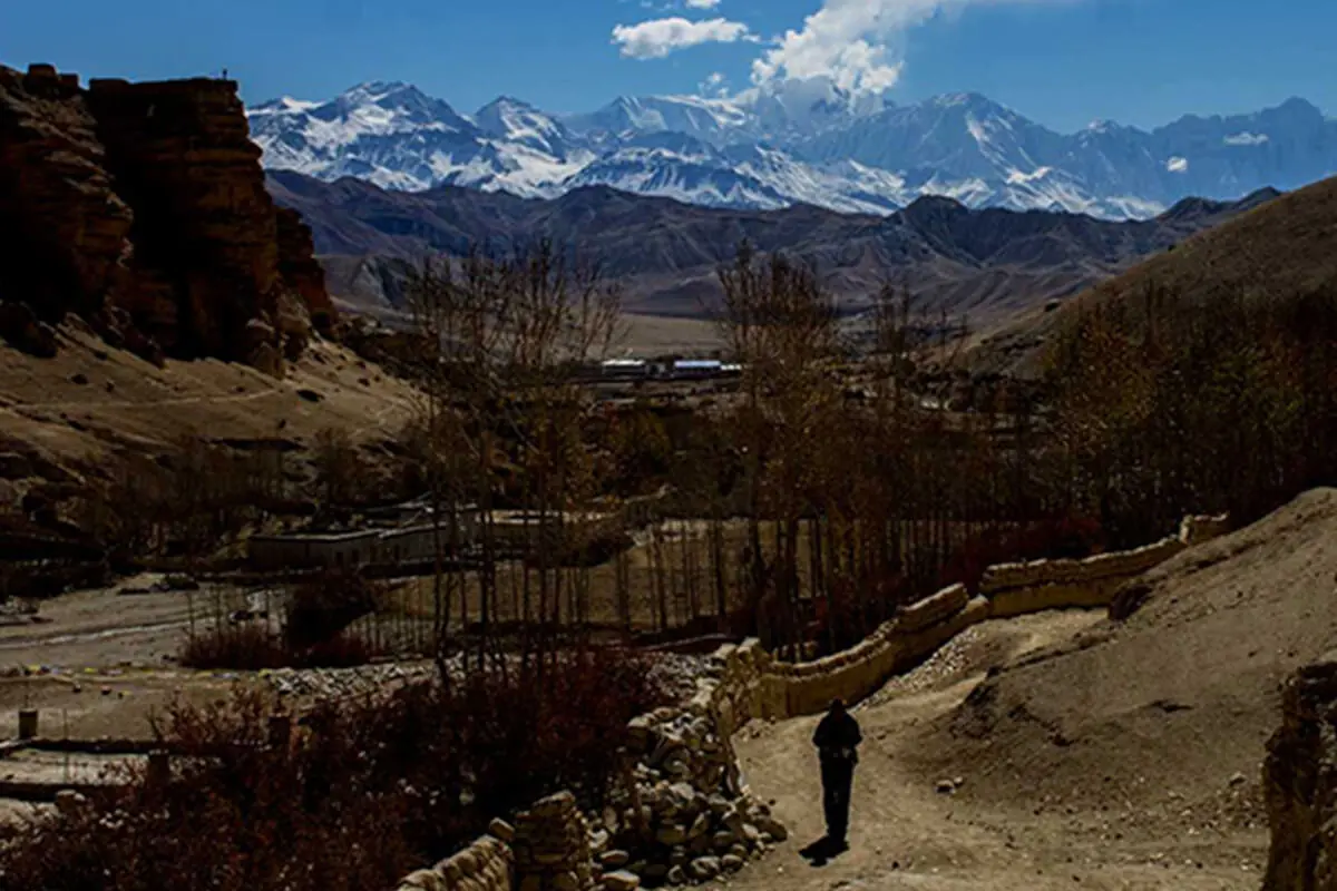
  • Enticing views of Nilgiri, Annapurna, Dhaulagiri, and other chains of mountains
  • Breathe the spirituality of the Tibetan-like people and monks with their prayer flags
  • Witness everyday life and culture of the local people who live closely, like the Tibetan Explore headquarters town of Mustang district and Lo Manthang, “the last forbidden kingdom".
  • Spectacular views of Mt. Annapurna, Thorung Peak, Nilgiri, Chulu west and east, Tukuche Peak, Dhaulagiri, Lamjung Himal, Annapurna II, and Annapurna IV
  • Magnificent lakes, glaciers, gorges, and waterfalls
  • Ancient Buddhist monasteries and mountain Tibetan lifestyles.

Upper Mustang Trekking unfolds the fabled forbidden kingdom’s vast and arid valleys, eroded canyons, yak caravans, colorful – painted mud brick houses on the back dropped of majestic mountain of Nilgiri, Tukche, Annapurna, Dhaulagiri and many mores snow mountains. Upper Mustang trekking is one of the best trek to do even in the monsoon time as the entire Upper Mustang lies in the rain shadow, north of Annapurna and Dhaulagiri ranges, completely sheltered from the monsoon downfall in Nepal.

We take both ways of Pokhara Jomsom Pokhara flight on this Upper Mustang trekking that does avoid the lower rainy section of Annapurna. The best advantage of doing Upper Mustang Trekking in monsoon time is that the village are full of local people busy at their every day works and the whole region are in bloom which makes really a fabulous contrast with the wind eroded hills, red cliffs and snow capped mountains on the back ground – a great vista. Thus upper Mustang trek is once in a lifetime destination to explore the fascinating medieval walled kingdom of Lo Manthang.

How to get Upper Mustang?

Jomsom is the starting point for the Upper Mustang region. Most people choose to take about 30-minute flight from Pokhara to Jomsom. We can also choose mountain overland journey by bus or jeep. Kagbeni, just north of Jomsom where as the official check point for Upper mustang Trekking.

How to get Upper Mustang Permit?

Upper Mustang Trekking is not only one of Nepal’s most spectacular treks, but one of the most privileged parts as well. It is only possible to apply through the registered trekking company which maintained a USD bank account. The online application form is available on the official website of the department of immigration, Nepal. Details on the passport, pictures, and an itinerary are necessary as well as valid visa of trekkers. The permits can be issued only in Kathmandu or Pokhara by the Department of Immigration.

When is the best time to trek Upper Mustang Trekking?

Upper Mustang Trekking is the rain shadow area of the Himalaya, making it an excellent monsoon trek ( June, junly and auguest ) and open year-round for trekking. The most crucial aspect in the winter, when most people leave the capital to prevent cold and snow. Upper Mustang Trekking can be one from March to the beginning of November.

Is there still a King in Upper Mustang?

No, Mustang is now governed by the state of Nepal. The last official king of Mustang is Jigme Dorji Palbar Bista, who still has his palace in Lo Manthang in Mustang

Itinerary Overview and Route Map

Day 3:Kathmandu to Pokhara ( Drive ), 830 m / 2723 ft, Distance: about 200 KM, takes about 6- 7 hrs
Day 4:Flight to Jomsom and trek to Kagbeni (930 m / 9186 ft.), Walking distance 3-4 hours
Day 5:Trek from Kagbeni to Chele(3050 m / 10006 ft.), Walking distance 5-6 hours
Day 6:Trek from Chele to Syangboche (3475 m / 11400 ft.), Walking distance about 6-7 hours
Day 7:Trek from Syangbouche to Ghemi (3500 m / 11482 ft .), Walking distance about 5-6 hours
Day 8:Trek from Ghami to Charang (3560 m / 11679 ft), Walking distance about 4-5 hours
Day 9:Trek from Charang to Lo- Manthang (3770 m / 12368 ft), Walking distance about 5-6 hours
Day 10:Explore around Lo-Manthang (3770 m / 12368 ft), visit to Chhoser Cave
Day 11:Trek from Lo-Manthang Dhakmar (3800 m / 12467 ft ), Walking distance about 6-7 hours
Day 12:Trek from Dhakmar to Ghiling (3860 m / 12664 ft), Walking distance about 5-6 hours
Day 13:Trek from Ghiling to Chhuksang (3050 m / 10050 ft), Walking distance about 5-6 hours
Day 14:Trek from Chhuksang to Jomsom (2715 m / 8907 ft ), Walking distance 6-7 hours
Day 15:Fly back to Pokhara (830 m / 2723 ft) , 25 min Flight Time
Day 16:Pokhara to Kathmandu (1,324 m / 4,344 ft) about 6-7 hour drive.
Day 17:Final Departure or Join other Trek / Tour

Upper Mustang Trekking- 17 Days Detailed Itinerary

Day 3

Kathmandu to Pokhara ( Drive ), 830 m / 2723 ft, Distance: about 200 KM, takes about 6- 7 hrs

After breakfast, we will drive to pokhara by Tourist bus. It takes about 7 hours drive. If you are taking a flight from kathmandu than we head off to Domestic Airport to take a 25 minutes flight to Pokhara. Enjoying with scenic beauty all the way around to Pokhara. Upon arrive in pokhara you will be enjoying the magnificent views of Dhaulagiri, Manaslu, Machhapuchhare, five peaks of Annapurna and others. In the evening, a boating trip on Phewa Lake will be followed where you can enjoy the spectacular views of Annapurna Himalaya Range reflected in all its glory in the calm green water of the lake and visit Bindavasini Temple lying in middle of the lake.

Max Altitude: 830m (2,723ft)
Meals: N/A
Duration: 6-7 hrs drive
Distance: 200 KM
Accommodation: Standard Hotel
Mode of Transportation: Tourist Bus
Day 4

Flight to Jomsom and trek to Kagbeni (930 m / 9186 ft.), Walking distance 3-4 hours

Your Upper Mustang adventure begins in earnest today with an early morning flight from Pokhara to the District headquarter of Mustang, Jomsom (2,720 m). A short yet scenic 25-minute ealry-morning flight with the towering Annapurna and Dhaulagiri mountain ranges. The aerial views are breathtaking, offering a first glimpse of the arid landscapes that define Mustang.

Upon landing in the windy, high-desert town of Jomsom, you’ll begin your trek to Kagbeni, the ancient gateway to Upper Mustang. The trail follows the Kali Gandaki River, passing through sparse settlements, windswept valleys, and dramatic cliffs. The spectacular and picturesque peaks of Nilgiri, Dhaulagiri, Tukuche Peak and Dhampus above the sparse brown landscape, as you walk on gently undulating trails until you reach Kagbeni.

Kagbeni (2,810 m) is a picturesque village with mud-brick houses, red-and-white-washed monasteries, and narrow alleys steeped in Tibetan culture. After reaching Kagbeni, take time to explore the village, visit the 14th-century monastery, and absorb the unique fusion of natural and spiritual beauty. 

Max Altitude: 930m (3,051ft)
Meals: B,L,D
Duration: 25 min flight and 3-4 hrs walk
Accommodation: Mountain Lodge
Day 5

Trek from Kagbeni to Chele(3050 m / 10006 ft.), Walking distance 5-6 hours

Kagbeni is the gateway of Upper Mustang Trekking, where we enter our special permit. After breakfast in Kagbeni, your trek officially enters the restricted Upper Mustang region. You’ll check your permits before continuing north along the Kali Gandaki River, walking through the scenic, picturesque wasteland landscape of the windy valley, following the trail that winds past canyons, caves, and eroded cliffs, offering a stark contrast to the greener areas of lower Mustang. Along the way, you’ll pass the picturesque Tangbe village, a maze of whitewashed houses, prayer flags, barley fields, and apple orchards. After a short break, you continue toward Chhusang, a small riverside village nestled beneath towering red rock formations, a perfect spot for lunch and rest. The town of whitewashed houses contains an intriguing pattern of alleyways and is surrounded by fields of wheat, barley, and buckwheat, interspersed with small apple orchards. The Nilgiri peaks, which dominate the southern skyline of Kagbeni, provide a spectacular backdrop. From here we trek forward to Chhusang, crossing the river and heading up to the huge red chunk of conglomerate that has fallen from the cliff above, forming a tunnel through which the Kali Gandaki flows. The trek now leaves the Kali Gandaki valley and climbs steeply up a rocky gully to Chele. As you arrive, you’ll notice a shift in the environment and culture; the landscape becomes more barren, and the architecture begins to reflect the Tibetan-influenced traditions of Upper Mustang.

Max Altitude: 3,050m (10,006ft)
Meals: B,L,D
Duration: 5-6 hrs
Accommodation: Mountain Lodge
Day 6

Trek from Chele to Syangboche (3475 m / 11400 ft.), Walking distance about 6-7 hours

Today’s trek from Chele to Syangboche is both challenging and rewarding, as you navigate some of the most dramatic terrain in Lower Mustang. The trail begins with a steep ascent along dry, rugged cliffs and narrow gorges, soon leading to the Taklam La Pass (3,624m /11,923 ft) through plateaus and narrow stretches with views of Tilicho Peak, Yakawa Kang, and Damodar Danda. From here, the trail undulates over windswept ridges and passes fascinating cave dwellings carved into the cliffs.

As you continue, you’ll pass through Samar, a charming village surrounded by poplar trees and barley fields, often used for a short tea break or lunch. After Samar, you’ll descend into a deep gorge and then climb back up toward Bhena and Yamdo La Pass (3,850 m) before arriving in Syangboche (3,800 m), a small, peaceful settlement overlooking a vast high-altitude plateau with incredible views, cultural encounters, and a deeper sense of Mustang’s remote beauty.

Max Altitude: 3,475m (11,400ft)
Meals: B,L,D
Duration: 6-7 hrs walk
Accommodation: Mountain Lodge
Day 7

Trek from Syangbouche to Ghemi (3500 m / 11482 ft .), Walking distance about 5-6 hours

Today’s journey from Syangboche to Ghami offers one of the most scenic and culturally rich segments of the Upper Mustang Trek. After breakfast the trail begins with a steady climb to the Yamda La Pass (3,850 m), where prayer flags flutter in the breeze and panoramic views stretch across Mustang’s high-altitude desert. From there, the trail continues through traditional villages like Gheling and Tamagaon, where whitewashed houses and mani walls reflect the deep-rooted Tibetan Buddhist culture.

After a lunch break and some rest, you’ll ascend again to the Nyi La Pass (4,010 m), one of the highest points on the trek, before making a steep descent into the beautiful village of Ghami (3,520 m). Nyi Pass is the highest point of the trek thus far and the southern boundary of Lo. The trail then drops steeply to the whitewashed buildings of Ghemi. Ghemi is surrounded by large fields, most of which are barren. The afternoon is in perhaps the driest part of Mustang and views of the countryside are magnificent with the rugged mountains in the east and west. Ghami is also known for its red cliffs, ancient chortens, and the longest mani wall in Mustang, stretching across the valley floor. It’s a quiet, atmospheric place to spend the night, filled with history and Himalayan charm.

Max Altitude: 3,500m (11,482ft)
Meals: B,L,D
Duration: 5-6 hrs
Accommodation: Mountain Lodge
Day 8

Trek from Ghami to Charang (3560 m / 11679 ft), Walking distance about 4-5 hours

Today’s trek starts off over rough and sometimes slippery ground as we descend to a suspension bridge over the Ghami Khola. The trail takes us passes the longest and most spectacular Mani walls (stone-built walls with Tibetan mantras carved into the stones) in Nepal over the Charang La Pass (3,870m). Then climb to a plateau, and from the end of the wall, the trail heads east to the village of Charang (Tsarang) with a maze of fields, willow trees, and houses separated by stone walls at the top of the Charang Chu canyon. At the eastern end of the village are a huge Dzong [fortress] and a red Gompa, which houses an excellent collection of statues and Thankas as well as many large paintings of seated Buddha’s. The huge five-story monastery fortress is perched on the edge of the Kali Gandaki gorge.

Max Altitude: 3,560m (11,679ft)
Meals: B,L,D
Duration: 4-5 hrs
Accommodation: Mountain Lodge
Day 9

Trek from Charang to Lo- Manthang (3770 m / 12368 ft), Walking distance about 5-6 hours

The trail descends about 125 m from Charang, crosses the Tsarang Chu and follows the track to a cairn on a ridge opposite the village at 3580 m, then enters the Tholung village. Dropping down into a canyon, we cross a river and ascend to the Lo La pass (3,950 m). From the pass we get our first look at the historic and beautiful valley of Lo Manthang (3700 m). This walled village is the traditional home to the King of Lo and is still the scene of many interesting and colorful Buddhist festivals. The surrounding mountains –Nilgiri, Tilicho, Annapurna I, and Bhrikuti Peak-add to the atmosphere of the place.

Max Altitude: 3,770m (12,368ft)
Meals: B,L,D
Duration: 5-6 hrs
Accommodation: Mountain Lodge
Day 10

Explore around Lo-Manthang (3770 m / 12368 ft), visit to Chhoser Cave

A day is is not enough to explore this outstanding historical and cultural center. Today we get to explore some of the mysteries of Upper Mustang. A short trek to the area of Chhoser is the beginning of a day you will not forget! Here we find what is known as the Jhong Caves or even Sky Caves. These are five-storey high caves built into the side of cliffs. Researchers are still puzzling as to who built these caves and why. It is assumed they were used as burial chambers, hiding places, places of meditation, and later, monasteries.

But no one really knows the origins of these amazing caves. We can explore some of these caves, taking a packed lunch with us so we can enjoy the atmosphere of the caves, lunar-like landscape, and mountains while relaxing. Then we head back to Lo Manthang where we overnight again.

Max Altitude: 3,770m (12,368ft)
Meals: B,L,D
Duration: day trip arund 5-6 hrs
Accommodation: Mountain Lodge
Day 11

Trek from Lo-Manthang Dhakmar (3800 m / 12467 ft ), Walking distance about 6-7 hours

Instead of following the trail south to Tsarang, turn southwest along an indistinct trail that passes the irrigated fields of the city. After Lo Gekar, the trail climbs steeply to a cairn on a pass at 4000m, offering a last glimpse of Lo Manthang. Cross the Chogo La (4325m), the highest point on this trek. The trail makes descend beside a stream visiting the ancient Ghar Gompa more than 1200 years old and meet the Guru Rimponche. Gompa is famous for its rock paintings andthe legend of fulfilling our good wishes. Climb to a ridge, the route crosses some alpine meadows to a crest and then drops down a steep eroded gully overshadowed by red rock towers to Drakmar.

Max Altitude: 3,800m (12,467ft)
Meals: B,L,D
Duration: 6-7 hrs walk
Accommodation: Mountain Lodge
Day 12

Trek from Dhakmar to Ghiling (3860 m / 12664 ft), Walking distance about 5-6 hours

After a peaceful night in the mystical village of Dhakmar, today’s trek leads you southward through the stunning, high-altitude landscapes of Upper Mustang. The trail begins with a gradual climb back through the desert-like ridges and windswept valleys, retracing part of your earlier route but offering new perspectives of the dramatic cliffs and wide, open plateaus. You’ll pass by Ghar Gompa once again if you didn’t visit it the previous day, a sacred and historic monastery linked to Guru Rinpoche. As you descend further, the terrain becomes more hospitable, with the occasional patch of green fields and stone-walled farms emerging along the way. We enjoy the majestic views of Mt Dhaulagiri and Nilgiri. By afternoon, you’ll arrive in Ghiling or Geling, a peaceful village nestled against a barren slope. Known for its traditional houses, ancient chortens, and a beautiful monastery, Ghiling provides a quiet and culturally rich overnight stay. 

Max Altitude: 3,860m (12,664ft)
Meals: B,L,D
Duration: 5-6 hrs walk
Accommodation: Mountain Lodge
Day 13

Trek from Ghiling to Chhuksang (3050 m / 10050 ft), Walking distance about 5-6 hours

Leaving the peaceful village of Ghiling, today’s journey takes you further south through dry plateaus, crumbling cliffs, and hidden valleys, gradually transitioning back toward the lower Mustang region. The path trekking back to Chhuksang is easy, working down and enjoying the Tibetan lifestyle and culture. You will have wonderful scenery and the amazing views of Nilgiri, Tilicho and other tremendous Himalayan peaks. You’ll pass Gheling and Samar villages and possibly stop for lunch in Chele before continuing on a winding path that eventually leads you back to Chhusang (2,980 m), a windswept village beneath dramatic red and orange cliffs. The descent in altitude brings warmer air and a shift in vegetation, with more greenery appearing along the riverside. Chhusang’s quiet alleys, apple orchards, and unique cliffside caves make it a peaceful and scenic overnight stop.

Max Altitude: 3,050m (10,006ft)
Meals: B,L,D
Duration: 5-6 hrs
Accommodation: Mountain Lodge
Day 14

Trek from Chhuksang to Jomsom (2715 m / 8907 ft ), Walking distance 6-7 hours

Today we walk down to the southern border of the Mustang region to Kagbeni. We gradually get down through old salt trade route; the stupa, monasteries and chortens (Buddhist shrines) are the main attractions of the day. After having lunch at Kagbeni, we will head to Jomsom following the Kali Gandaki River Bank with an easy and flat work. Continue the trail down on the stony path facing Tukuche, Dhaulagiri and Nilgiri. Explore the headquarters city and have your overnight stay here.

Max Altitude: 2,715m (8,907ft)
Meals: B,L,D
Duration: 6-7 hrs walk
Accommodation: Mountain Lodge
Day 15

Fly back to Pokhara (830 m / 2723 ft) , 25 min Flight Time

Early morning we will take a short picturesque flight to Pokhara. The views of Annapurna and Dhaulagiri mountains and the world’s deepest gorge, Kali Gandaki are stunning. Relax the whole day in the hotel or wander around Lakeside with its fascinating mountain panorama view and charming nature.

Max Altitude: 830m (2,723ft)
Meals: B,L,D
Duration: 25 min flight
Accommodation: Mountain Lodge
Day 16

Pokhara to Kathmandu (1,324 m / 4,344 ft) about 6-7 hour drive.

Flight (can be arranged on request) from pokhara to Kathmandu. We take regular tourist bus back to Kathmandu. Free time around Kathmandu for shopping. Evening, we will invite you to have Nepali an authentic dinner as a farewell dinner with Nepali cultural show.

Max Altitude: 1,324m (4,343ft)
Meals: D
Duration: 6-7 hrs drive
Distance: 200 KM
Accommodation: Standard Hotel
Day 17

Final Departure or Join other Trek / Tour

We transfer you to the International Airport 3 hours before your flight departure. Back home sweet home, hope to see you again. Or Join our amazing add ons packages

Meals: B
Are you still confuse from where to start? Trekking Plus has solutions for this.

Cost Details

Includes

  • Regular tourist bus to and from Pokhara (if you are going by flight, there will be an extra cost).
  • Accommodation in Pokahra for 2 nights ( standard hotel basis with breakfast included).
  • Flight ticket to and from Jomsom including airport taxes.
  • Lodge accommodation druing the trekking (Tea House Mountain local lodge, shared bathroom).
  • All meals (Breakfast, Lunch and Dinner) during the Trek with fresh fruits and hot drinks (Tea / coffee ). 
  • Trekking Plus Expert Trekking Guide and Porter (1 porter between two trekkers) to assist with carrying your gear during the trek.
  • All expenses of Guide and Porter's meals, lodging, salary, transport, insurance, equipment, and other essentials. 
  • Upper Mustang Restricted Area special Trekking Permit US $ 50 per day per person (the above price includes valid trekking permit from Kagbeni to Kagbeni. 
  • Annapurna Conservation Area Permit (ACAP) and Trekker’s Information Management System (TIMS) card fees. 
  • Assistance in case of emergency. 
  • Farewell Dinner in Kathmandu
  • All Government and local taxes.

Excludes

  • International Flight.
  • All accommodation and meals  in Kathmandu
  • Lunch and dinner while you are in Pokhara.
  • All personal expenses such as laundry, telephone calls, bar bills, beverages, battery recharge fees, snacks, hot showers, bottle of water. 
  • Personal Trekking equipments. 
  • Travel Insurance (should cover helicopter evacuation if in case of emergency) 
  • Tipping to Guide and Porters.
  • Any additional costs or delays caused by unforeseen cases such as landslides necessitating trail diversions, weather delays, political unrest, illness, et cetera. 
  • All the costs and expenses which are not listed in "cost includes" will be counted as excluded

Essential Information

Important to note, please visit our Equipments check list. Altitude Mountain Sickness section for additional details of what you need to bring on trek as well as prevent about AMS. Trekking Plus top priority is the safety and security of our customers and staff during all of our trips.

Our top priority is the Safety and Security of our customers and staffs during all of our trips. Trekking Plus field crews bring normal first aid kits on all of our tours, which is readily available for both customers and staff but we will recommend you to bring first aid kits yourself from your country because Nepalese medicine some time does not work properly. We are constantly in communication with our field office and monitor all aspects of government and weather issues that might affect your trip. Also, we are always available 24 hours emergency contact.

Drinking water

We will get mineral and boiled water along the trekking routes which is also an additional cost. We discourage not to buy Mineral bottle water but use boiled water from the local lodges and put water purify tablets. Plastic bottles are difficult to dispose off and have become an environmental problem in mountains.

What to take

Trekking Plus offers you a Trekking maps as a complementary and Company T-shirt.Trekking Plus would suggest you to pack as lightly as possible when you are on mountain. We provide one porter between two trekkers to carry your trekking gears. You will be carried your valuable things in a day pack by your own and your other bags will be carried by the porter in a duffel bag which we provided. Porter carries about 25 KG from 2 trekkers. You can store you’re your luggage which you are not going to use it on trek can leave in Kathmandu Hotel which is free of cost. Please visit our FAQS for more details. 

Health, fitness and experience requirements

Upper Mustang trekking trails insistence excellent stamina as well as the best health condition.  We suggest you to consult with your doctor before planning this trek. Trekkers are also requested to take advice, medications and permission from their doctor prior to planning their trek. Also, it is highly recommended to take expert guidance before you start your trek. Some days of the trek require 8-9 hours of walking. Thus, the trek demands excellent stamina. Therefore, regular exercise and jogging is recommended to build up the required stamina to successfully climb the peak. 

Though, the trail to Upper Mustang takes you to some of the most demanding sections of the Upper Mustang region, no prior experience is required to climb this peak; however, prior experience in climbing, camping and hiking will definitely be counted as a plus point. Please submit your medical fitness certificate that includes your present health condition, medical situation, the preceding illness and the medication you are taking prior to booking this package. You are also requested to be honest so that, we can prepare ourselves to take quick action in case of emergencies.

Why is Upper Mustang a Restricted Area?

Because of its remoteness and inaccessibility; Mustang was a protected region in the Himalayas. The area used to be a separate kingdom inside the boundary of Nepal until 1950. Later, because of its popularity, it was opened for outsiders to explore from the year 1992 AD. Still, foreigners require a special permit to enter this region.

Upper Mustang Trekking- 17 Days FAQs

When is the ideal time to go on the Upper Mustang Trek?

Spring (March to May) and Autumn (September to November) season are the best time to do Upper Mustang Trek. These two seasons provide excellent weather, clear skies, and reliable trekking conditions.

What is the difficulty level of the Upper Mustang Trek?

Well, the Upper Mustang Trek is rated as moderate to fairly strenuous. The trail is not as physically demanding as other of Nepal's more difficult climbs, such as the Everest Base Camp or Manaslu Circuit Trek. Trekkers should, however, be in good physical shape and be prepared for long days on challenging terrain.